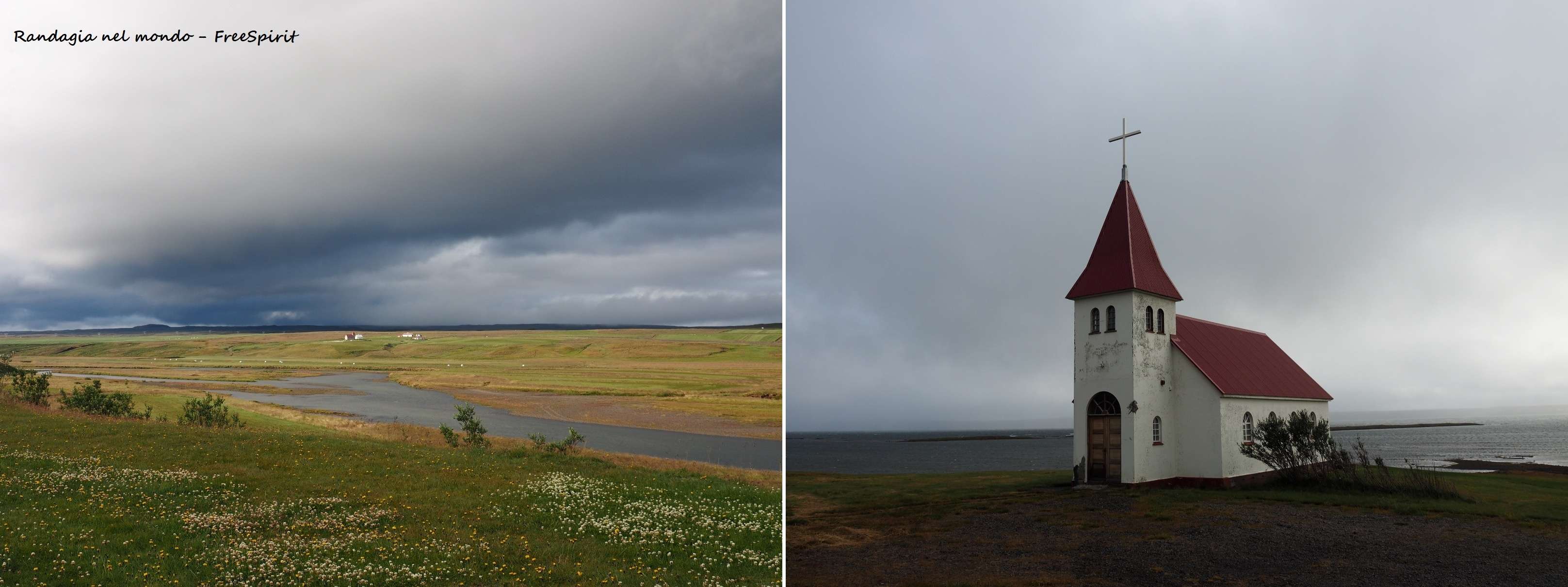
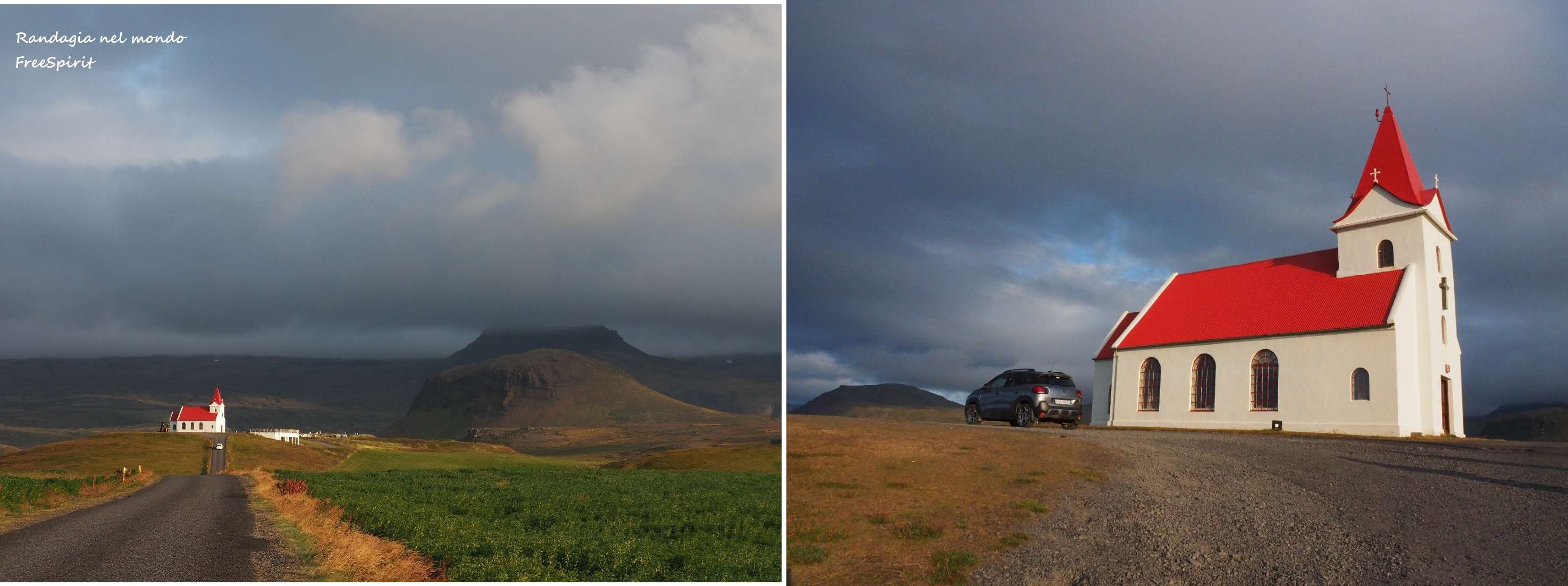
We leave Laugarbakki at 8 in the morning, the weather seems to promise well, but after a few km it degenerates. The forecasts are bad and already in front of the church of Prestsbakki we find ourselves immersed in the fog, and drenched in rain
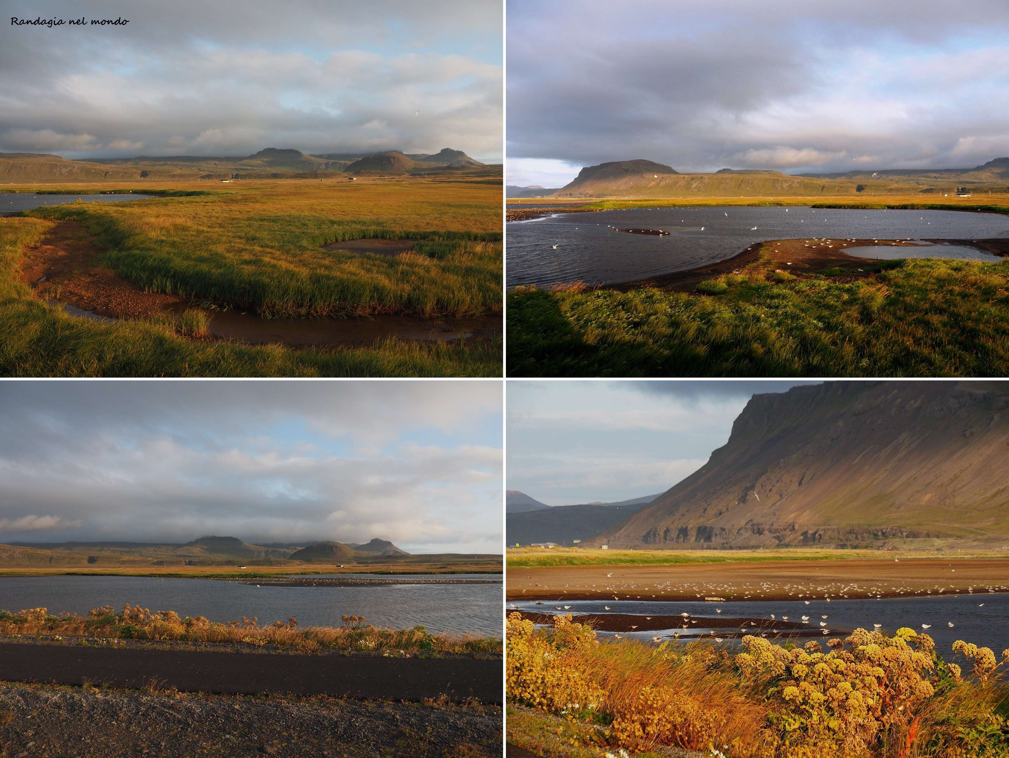
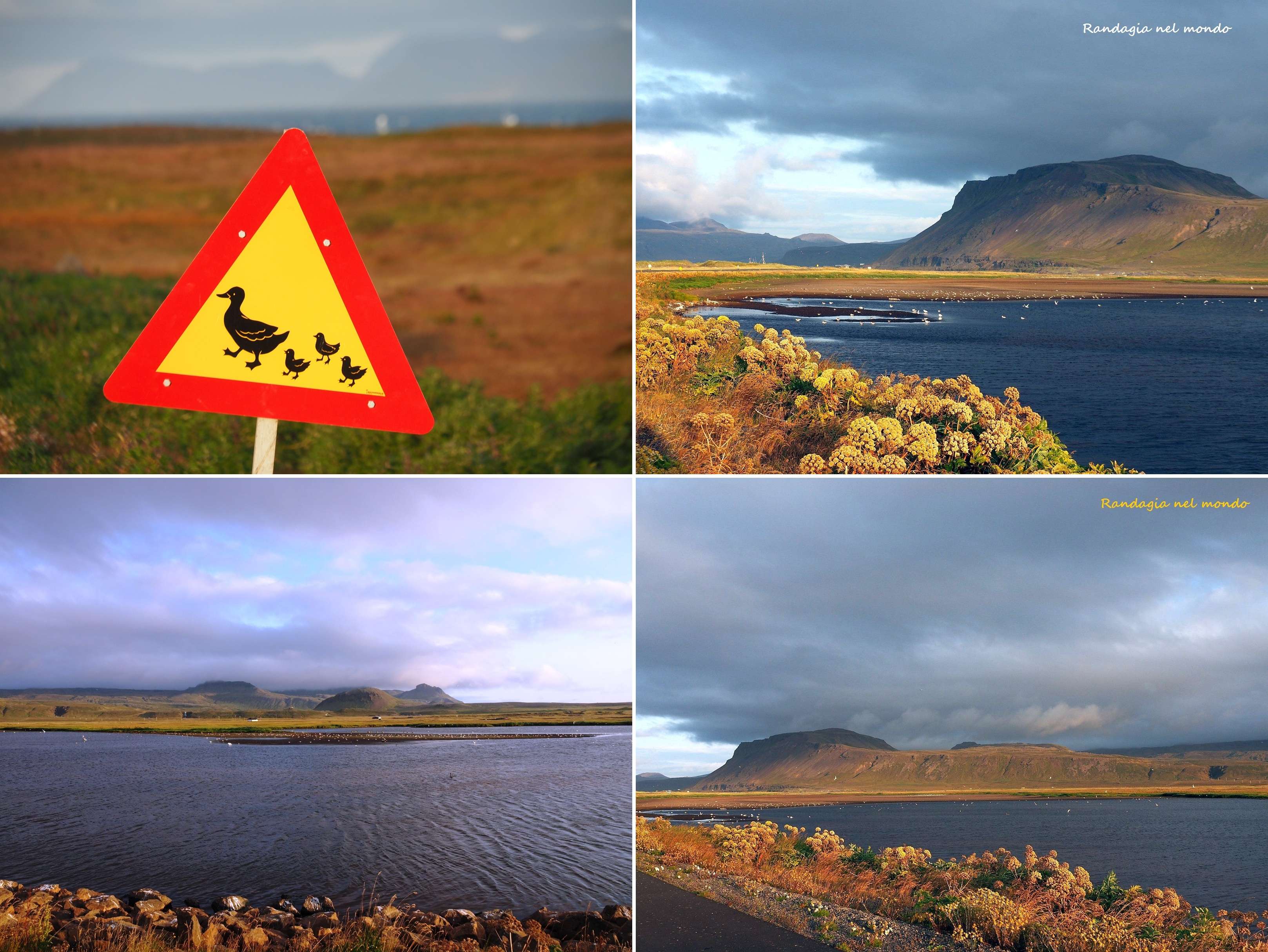
Visibility on the road is good, but as you can see from the photos, the picture we see from our windshield over the asphalt surface is rather limited! The magnificent panorama of the fjords is therefore precluded. On the positive side, the roads are still in perfect condition

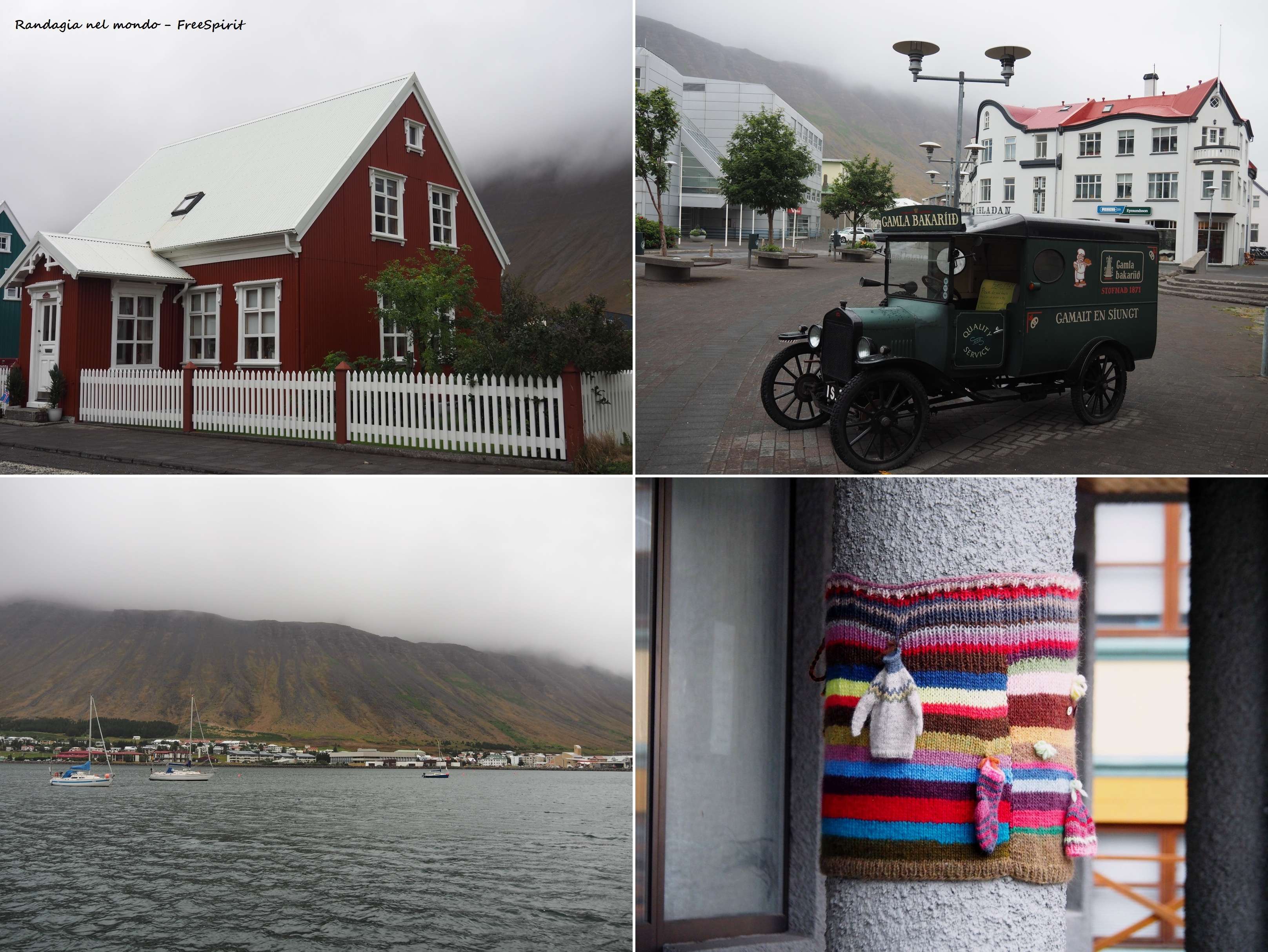
We reach Ísafjörður quite early in the afternoon, the hills around are immersed in a white blanket of clouds. We have a short tour of the city, the most important in the region, founded in the ninth century and important hub of fishing-related activities. The city center, with the colored wooden houses and the harbor, is pretty. Gamla Bakaríið is a renowned bakery, but unfortunately it is closing when we pass by it. What strikes me most are the knitwear hanging near the columns and walls of a building, perhaps in front of a shop that sells them; in fact I think I read that in addition to fishing another source of wealth for the local economy is made up of knitwear production, and here you can find the best lopapeysur in the country
Fortunately, the Gamla Guesthouse, where I booked a single room at 55 Eu by contacting the hotel directly, is very comfortable. Not the same can be said about the Ísafjörður Hostel where my travel mate is staying
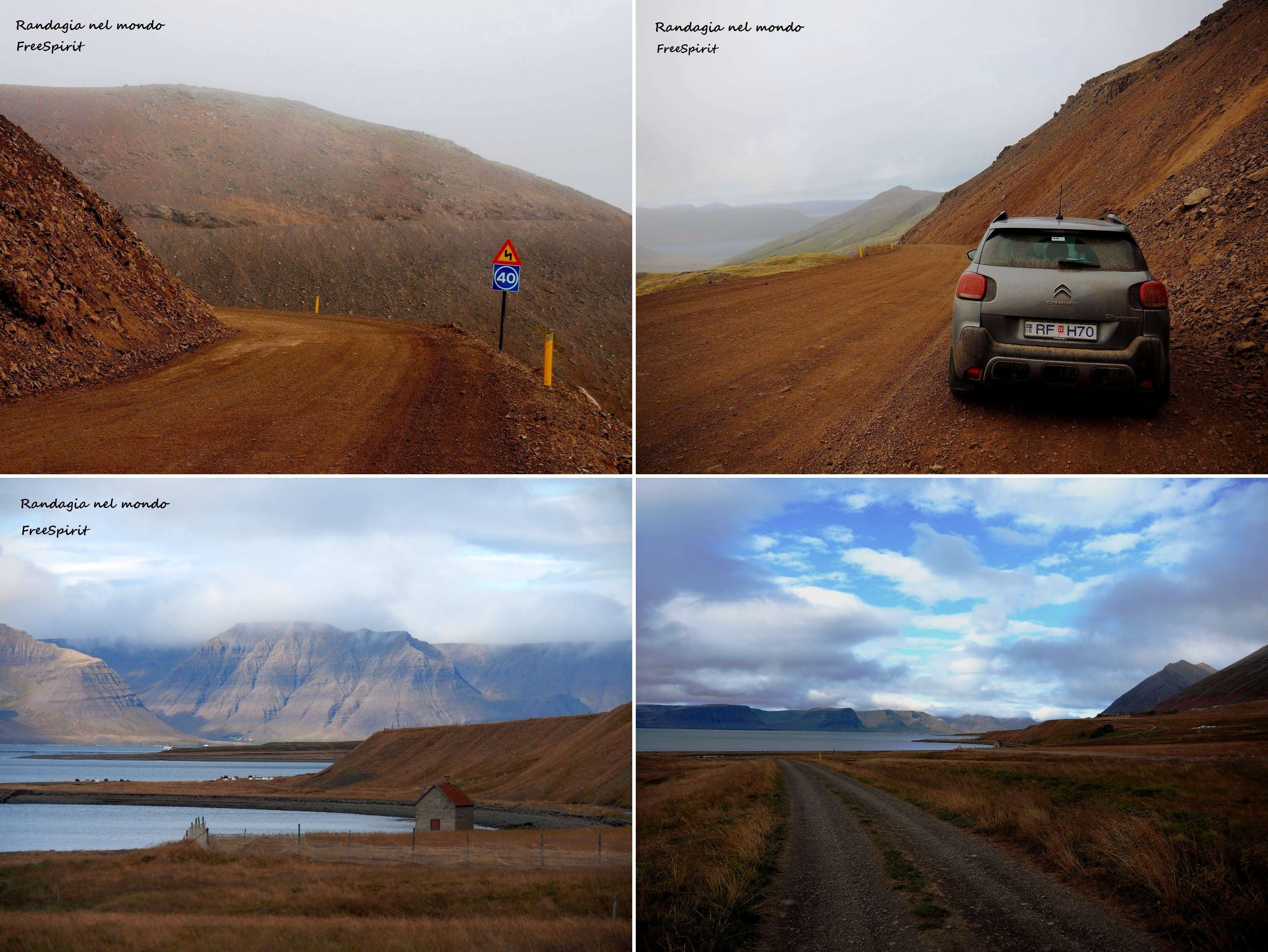
The second leg of our very short tour of the western fjords, from Ísafjörður to Reykhólar, will prove to be quite long and demanding, given the presence of a long stretch of dirt road, starting from the junction with the 62 and then along the entire 612 road which arrives to Latrabjarg. Even with a two-wheel drive car we had no problems, proceeding prudently at low speed, also to avoid damage to the car with consequent financial penalties from the car rental company. Like paved ones, dirt roads are also kept in excellent condition.
The first point of interest along the way, apart from the breathtaking views between the downhill hairpin bends, are the Dynjandi waterfalls, much less present than others on Google Images, (these roads are much less traveled than the N1) but no less spectacular. They are the most impressive in the region. They are composed of 7 different falls, with a height of about 100 meters. They remind me of a bridal veil.

It is possible to hike to the top but unfortunately time is running out and we must give up and go back after reaching the middle way. Subsequently the beach of Breiðavík, also called “the Caribbean of Iceland”, is very suggestive. The sand is beautiful golden colored, with the sun it must be splendid. We do not have time to deviate and go down to the coast, but already with the gloomy sky the glance from the road above is exceptional.
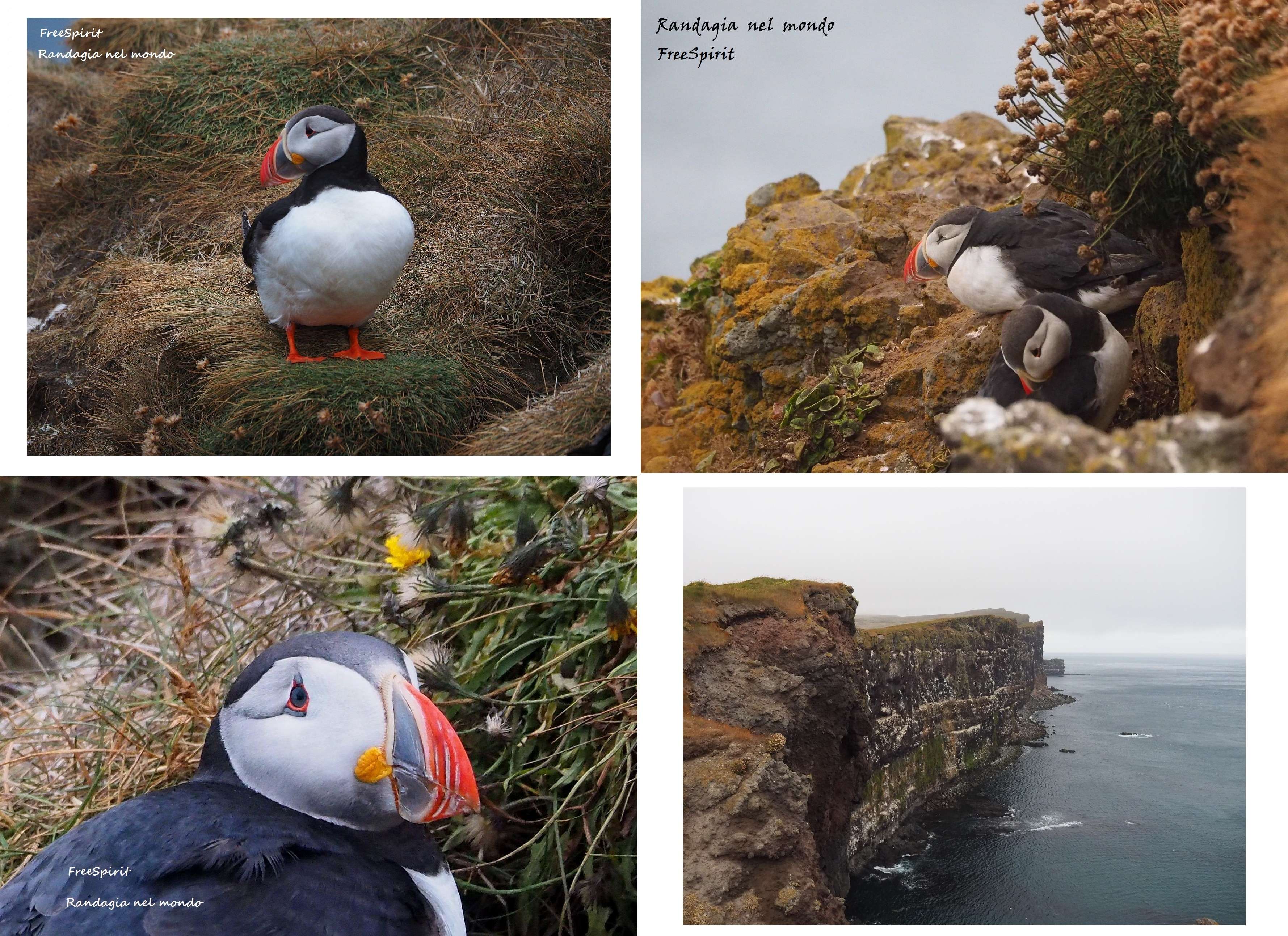
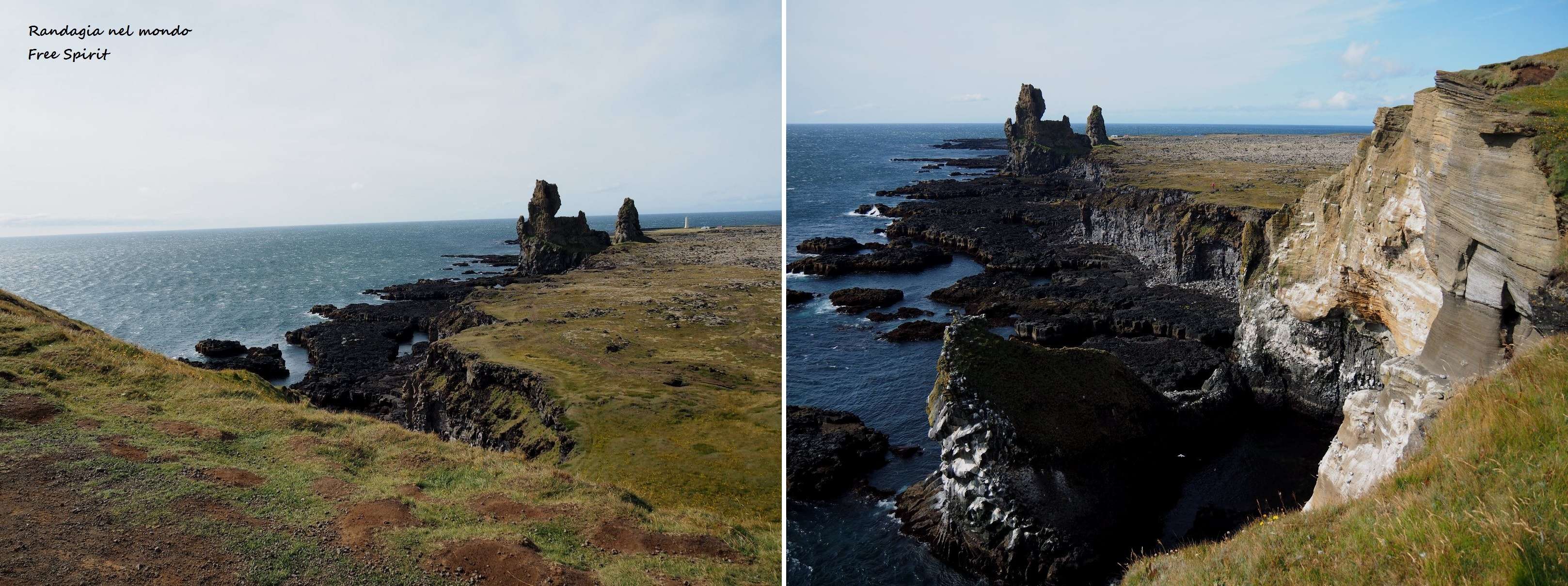
Finally we arrive, welcomed by an incredible wind, to the Latrabjarg promontory, the westernmost point of Iceland and Europe, populated by birdlife, first of all the nice puffins, but also seagulls, gannets, cormorants and marine magpies. Lonely Planet says seals can be spotted on rocks at sea, but we are not lucky. After having left your car in the parking lot, you can walk a path on the perimeter of the cliffs, which stretches for about ten kilometers. There are no toilets at the parking lot, but I remember having seen some on the left going towards Latrabjiarg, shortly after leaving Breiðavík beach. You can’t go wrong, they are signposted, and in any case there are always some cars parked in front
We reach our guesthouse in Reykhólar at around 9.30 pm. (a single room 60 Eu through Booking). Having notified our hosts of the delay, we do not find anyone to welcome us, but the entrance door is still open, with the keys stuck in the lock. We are in a building annexed to a farm, isolated, splendidly silent, with a magnificent view from the kitchen and living room windows.
The next morning, during breakfast, the friendly owner comes to visit us, and delights us with a series of anecdotes and advice on interesting things to visit in the surrounding area. Weather is getting better, but not yet completely stable.

Sometimes the elements of nature grace us, freeing us from the rain during our stop in Stykkishólmur, in the northern part of the Snæfellsnes peninsula, a village populated by seagulls, with great ecological awareness and an economy based on tourism and fishing. The Baldur ferry connects the city with Brjánslækur, but honestly on these coasts I prefer to drive rather than sail. I can enjoy the landscapes much more. Here is the link where you can find timetables and prices. We walk along the Sùgandisey peninsula, behind the marina


Bad weather, however, scourges us again at the highly photographed Kirkjufellsfoss waterfalls. Finding a place to park our car here is a challenge. I am sorry to report that many tourists of Asian origin, perhaps not accustomed to the narrow and winding streets, always drive in the middle of the road, without pulling over when others want to overtake them, and park anywhere, even in places where there are signs of prohibition, and do not care if their vehicle hampers the maneuvers of other cars to go back to the street
It is finally cleared up in the late afternoon, when we reach our guesthouse in Rif, near Ellissandur. Gamla Rif, a double room, booked through Booking, cost 102 Eu
We head to Ellissandur. A splendid warm light cheers us as we hike in a volcanic landscape to a belvedere located in the crater of Saxhòll. It is a short and easy walk, the site is reached by a short dirt road that branches off from the N1, and to get to the top they even built flights of stairs
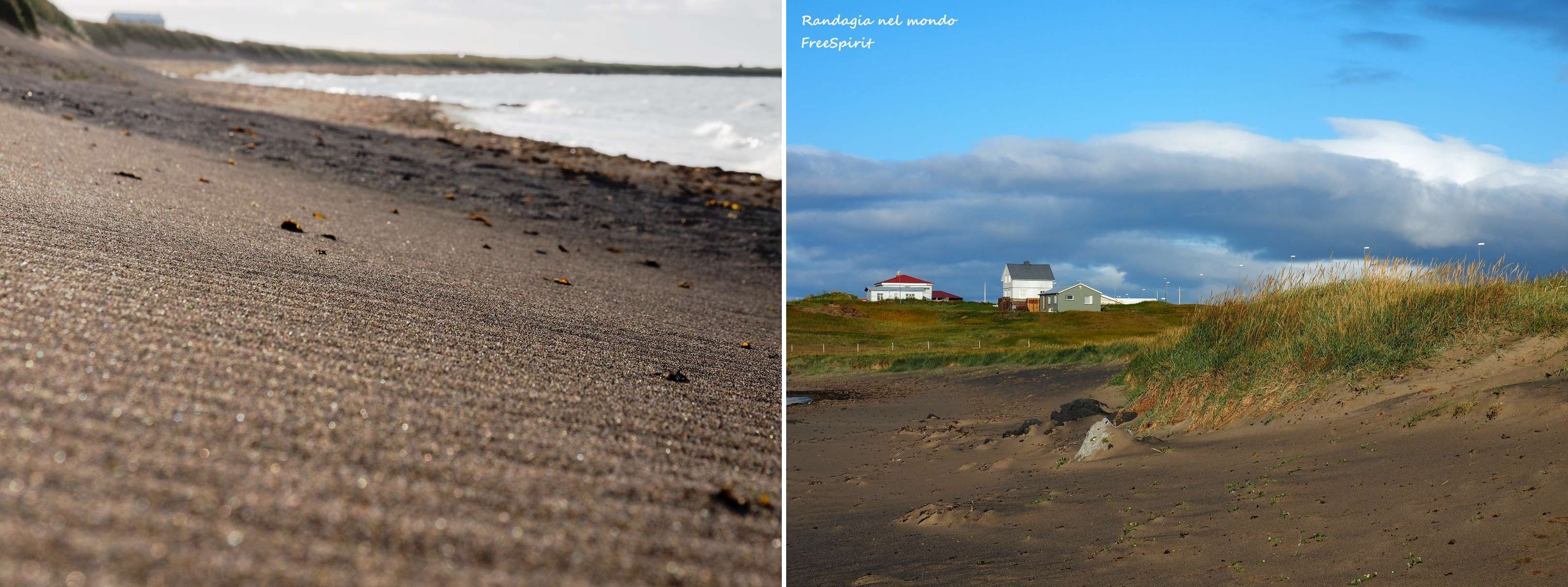
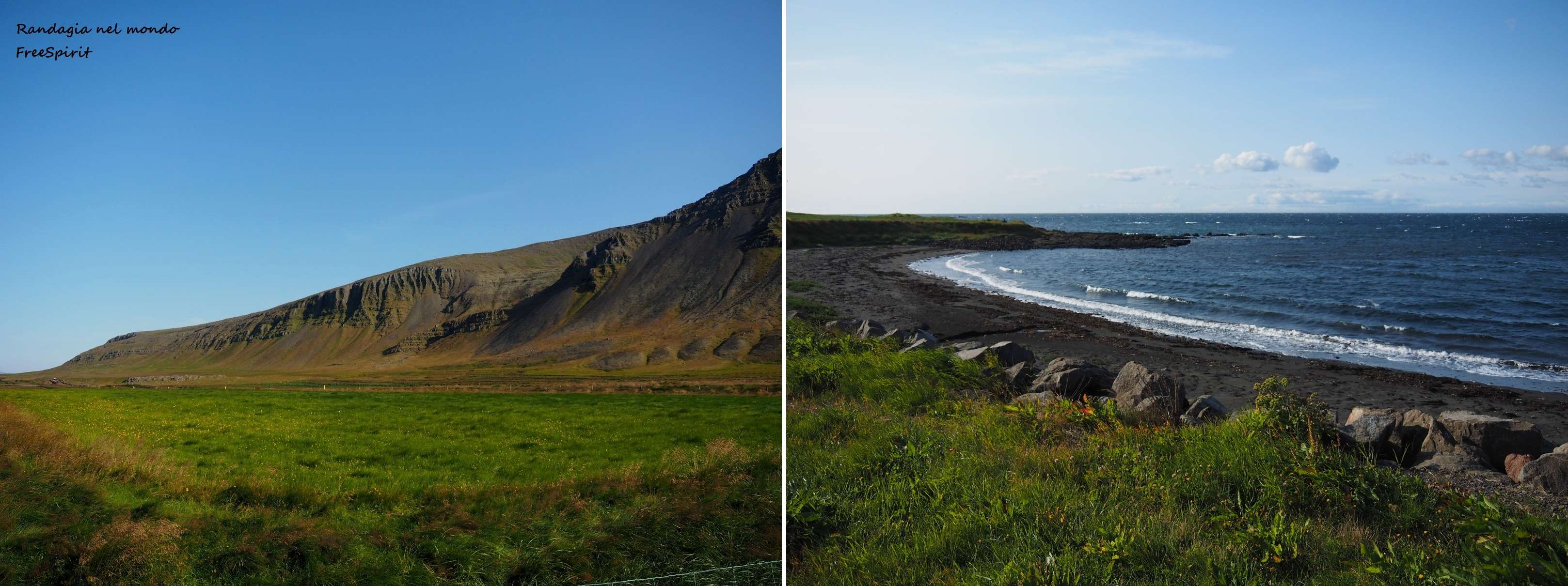
On the way back, always in Ellissandur, we have a walk on the beach
and have a look at Ingjaldshóll church, which is said to have been visited by Christopher Columbus in 1477
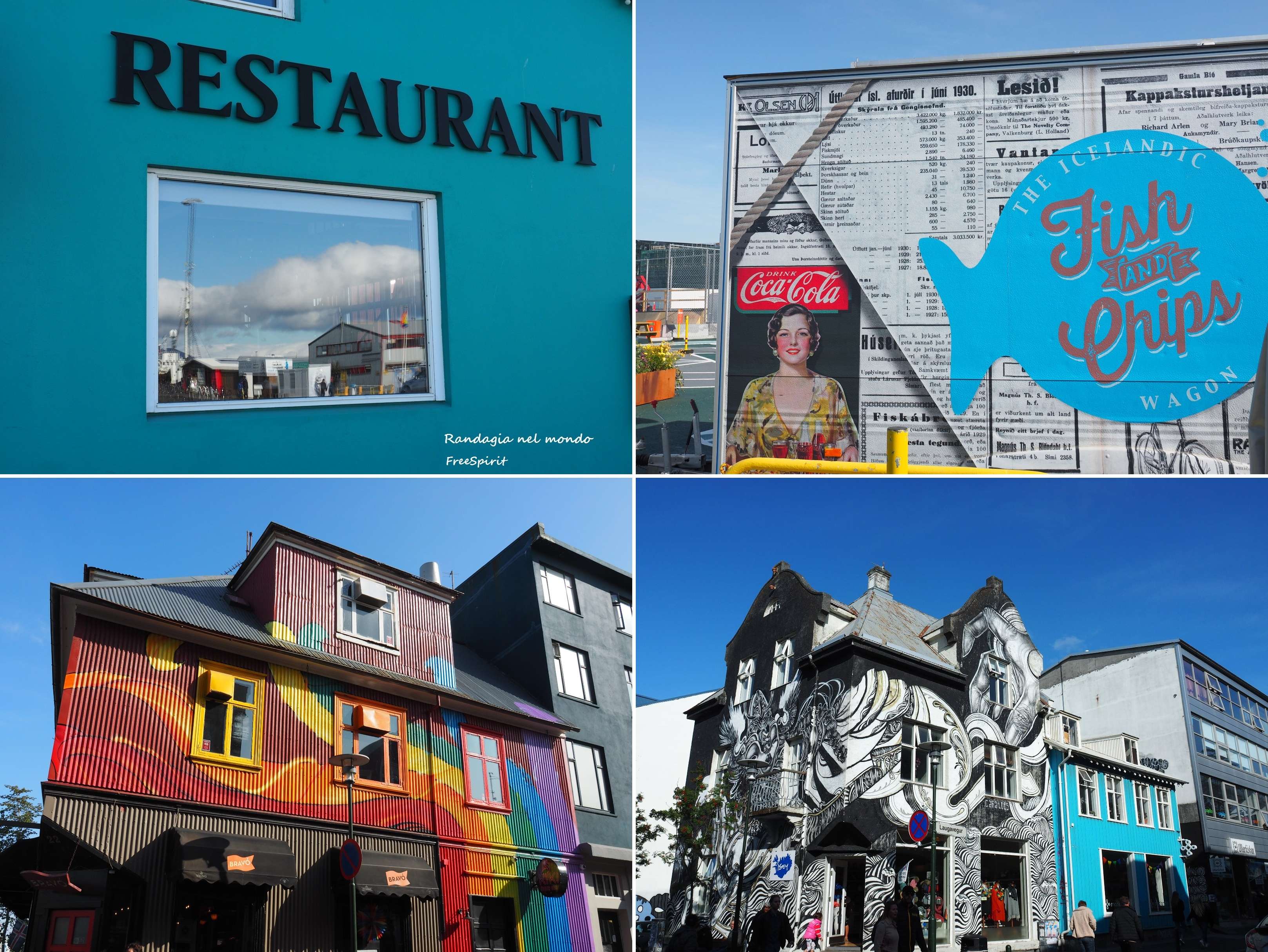
and then the murals

At the crossroads between the N1 and the road leading to the port, we linger in admiration in front of pools of water and ponds populated by birds, there are also huts to observe them without disturbing them.
Our guesthouse welcomes us around 9 pm, we prepare dinner and relax. For those who have never been to the north, this photo was shot at 00.50

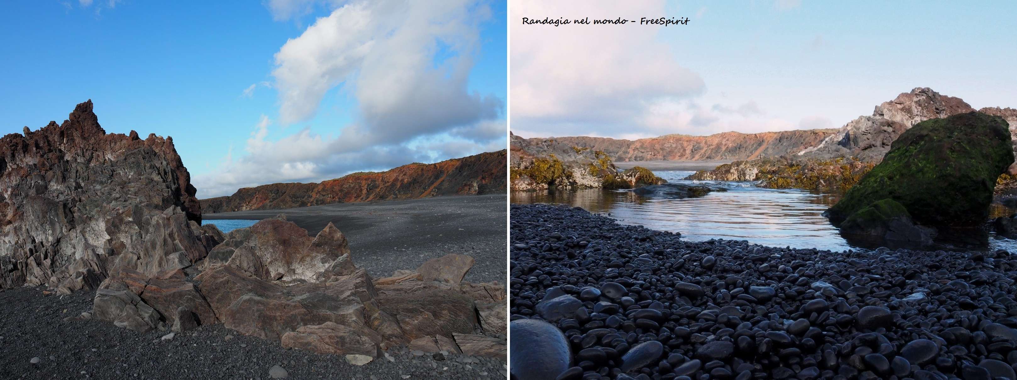
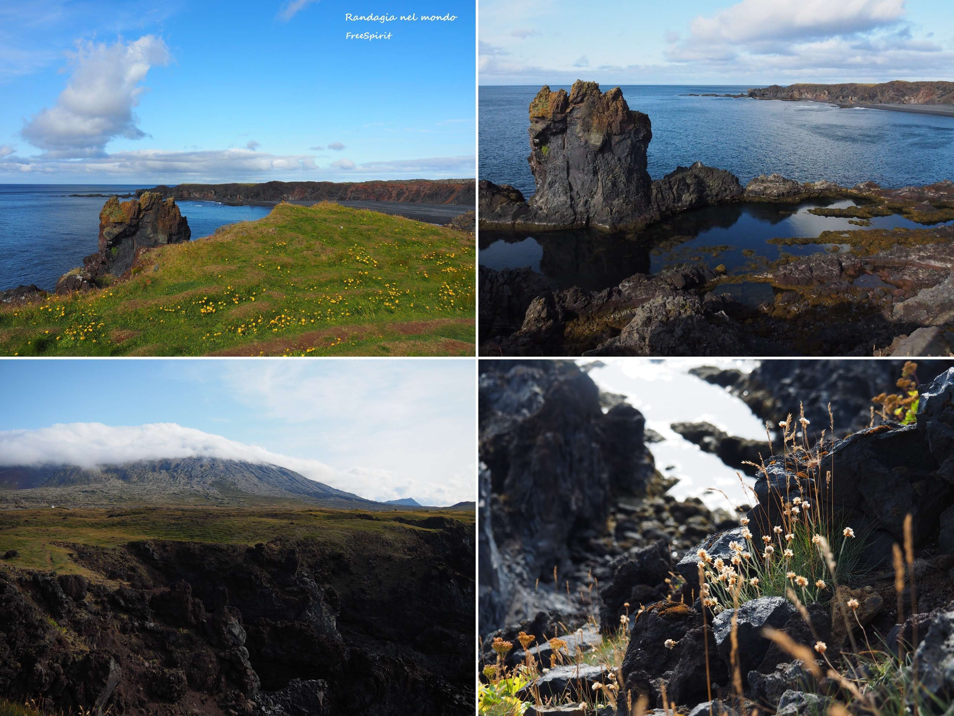
The next morning, finally with a wonderful sunshine, we reach Djúpalónssandur, or black lava pearl beach, where we spend quite a lot of time, walking first on the beach starting from the path of Nautastigùr, (that is the path of the bull), through huge lava formations. From an orifice located inside a cliff called Gatklettur you can see the Snæfellsjökull glacier. The largest boulder, square in shape, with a color more tending to redish (seen in the photos), is called Söngklettur (the singing rock). It is said to be a church of the elves. According to the new age legends, it is good not to climb these boulders chosen by the elves, disobedience generates a long sequence of bad luck. Furthermore, the Icelandic sagas say that some of these rocks were in the past trolls, which turned into stones after seeing the light of day.

It is also possible to walk on the ridges that surround the beach
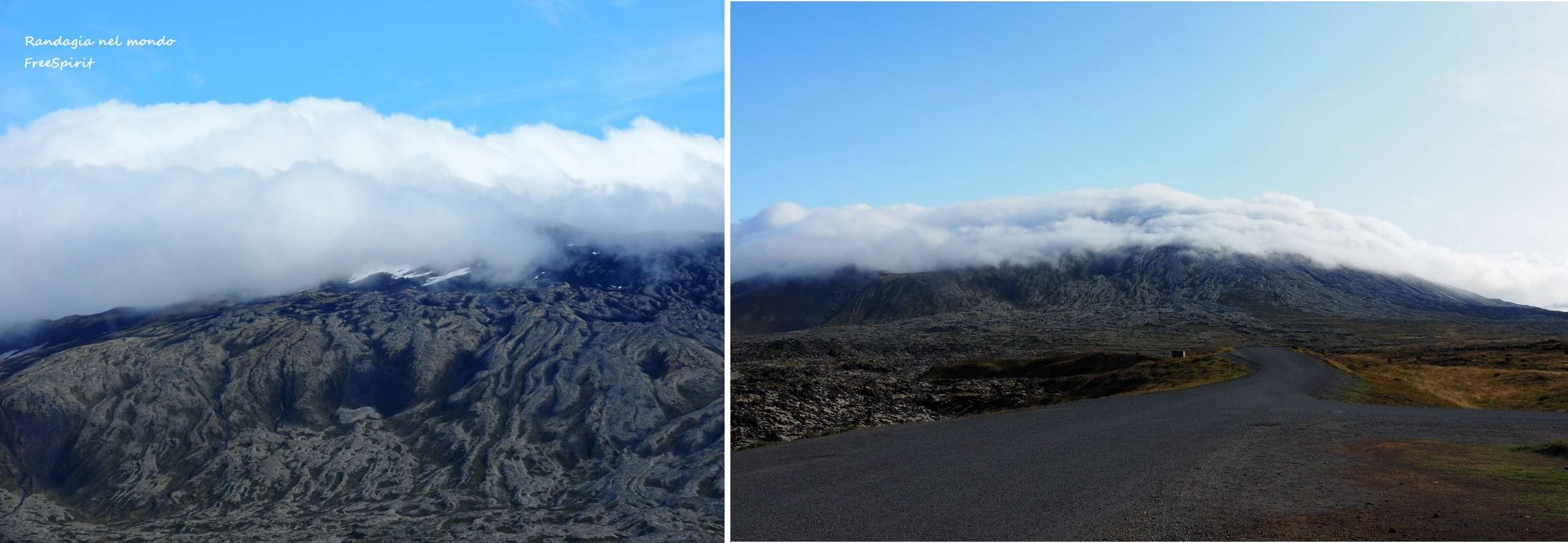
We therefore pass next Snæfellsjökull (the Snæfell mountain on which the glacier is located is also mentioned in Jules Verne’s book “Journey to the center of the Earth”)
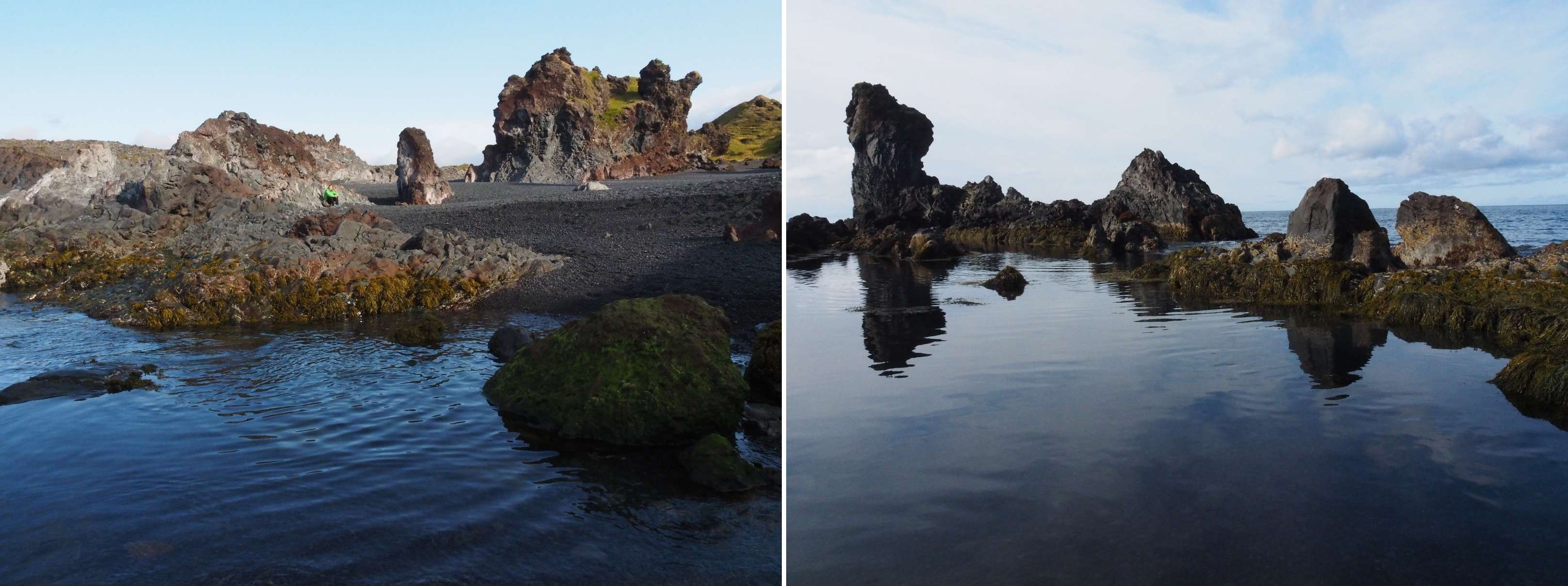
before reaching the basalt stacks of Londrangar
We then arrive at the village of Hellnar where we admire the cliffs populated by seagulls,

and Arnarstapi, where we have lunch
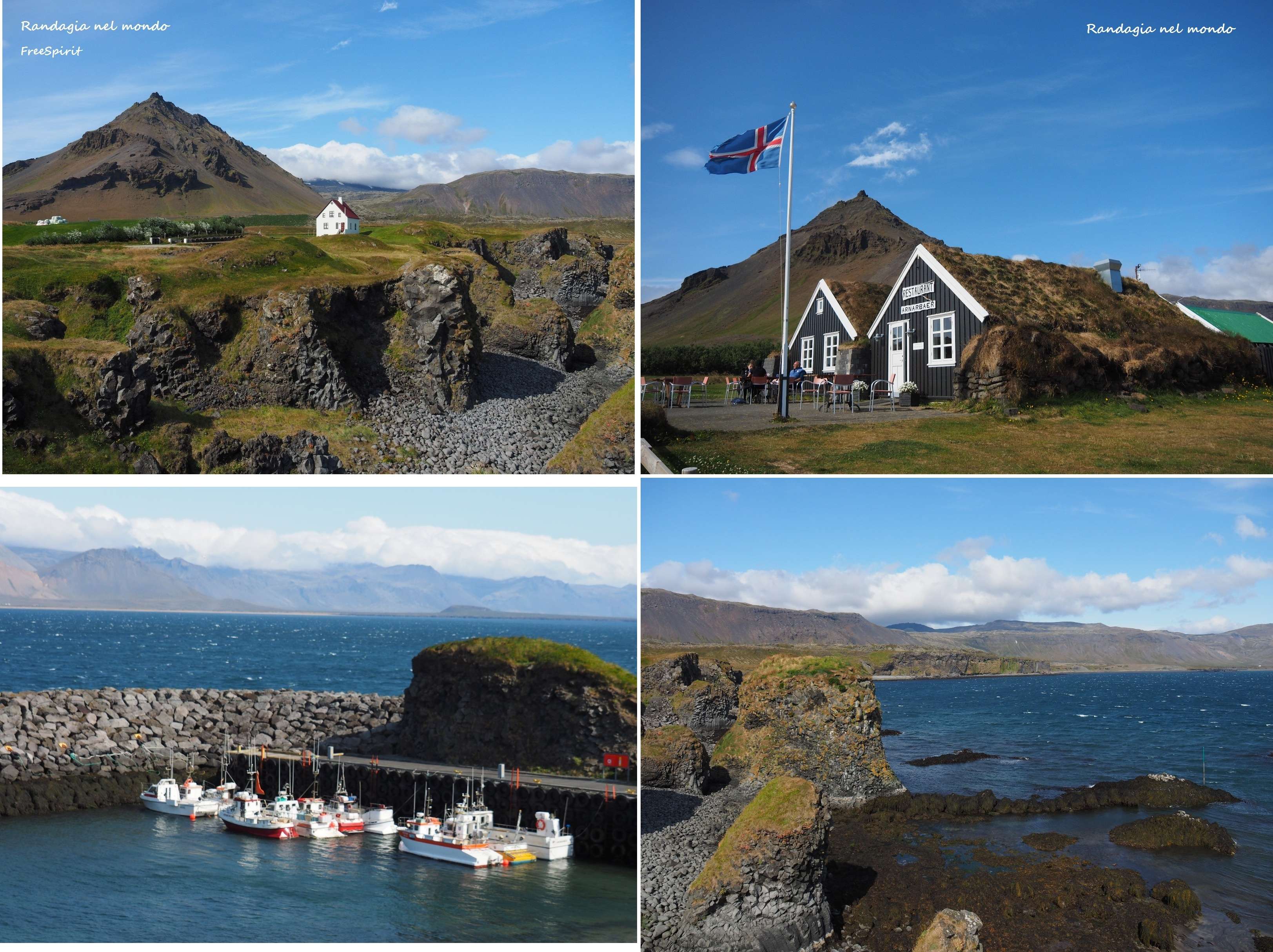
Hellnar and Arnastapi, as well as from the N1, are connected by a coastal path that I imagine wonderful, judging by what I can see when driving.
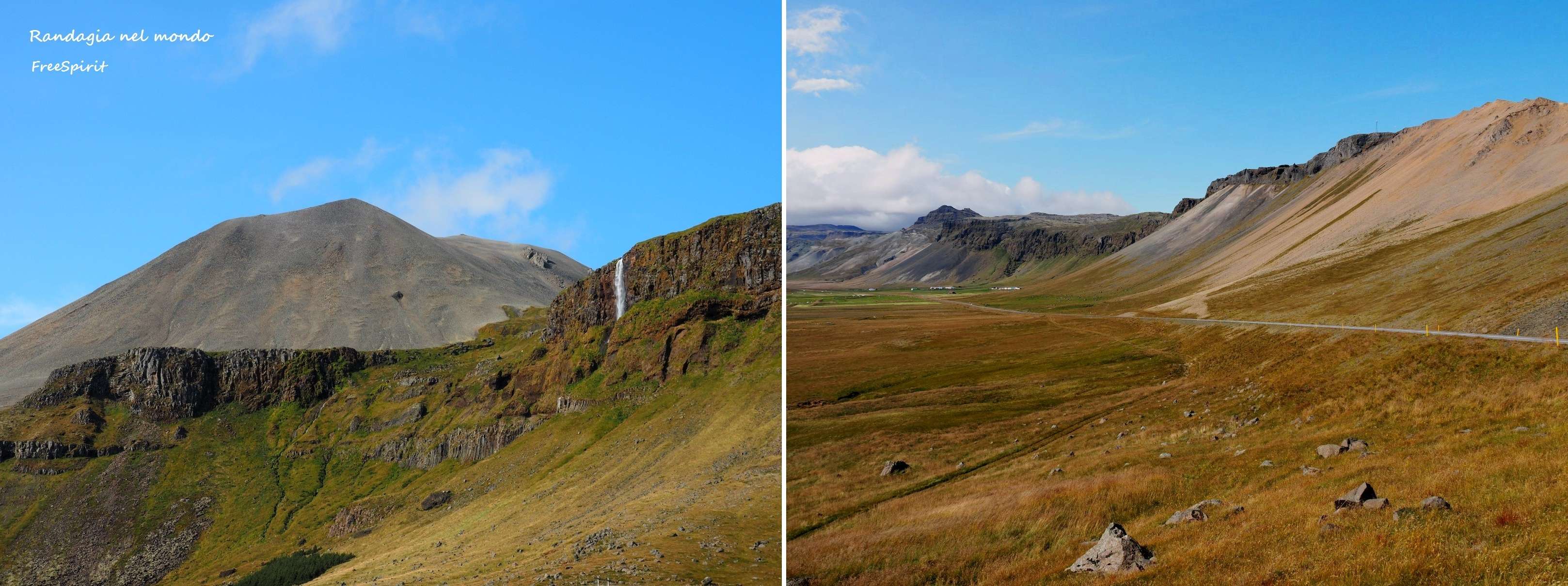
Shortly thereafter, other splendid panoramas in Langaholt

After another stop at Borgarnes and Akranes
we finally reach Reykjavík, which looks like a metropolis from afar, and our guesthouse booked through Air BnB, very close to the city center (111 Eu a double). We decide not to cook for dinner (our guesthouse is stocked with stuff left by other guests) and to try the local delicacies in a very popular bistro on Tripadvisor, Icelanding street food, but we were not particularly impressed. My stockfish and potato puree, similar to Ligurian brandacujun, was passable, but nothing special. I can’t say the same for my travel mate’s shrimp soup, a kind of broth, not very dense, where a few crustaceans sadly float. We spend the evening and the day after visiting the city, which to tell the truth does not excite me. The areas I prefer are those around the old port, the walks around the Tjornin basin, and the architecture of the Harpa Concert Hall and Cultural Center


However, there are several shopping opportunities for those who, like me, always devote themselves to this activity at the last second, along the Skólavörðustígur, the street that leads to the Hallgrímskirkja from the center, and the adjacent streets. Hallgrímskirkja is the cathedral the architect Guðjón Samúelsson designed inspired by the Svartifoss waterfall.
Since the return flight is at 8 in the morning, I spend the last evening in the surroundings of the airport, in an excellent Air Bnb in a single room found at 33 Eu. The next morning, the procedures for returning the vehicle to the car hire are very fast, while long queues for check-ins are formed at the airport. I have the impression the reception capacity of the structure is no longer proportionate to the constantly growing flow of passengers